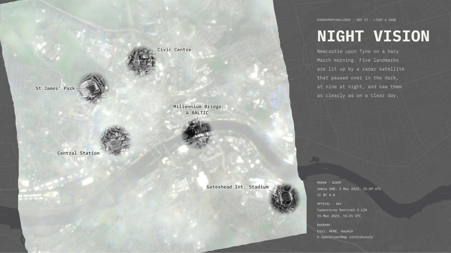
Here’s my entry for Day 17 of the #30DayMapChallenge, “Light & Dark”. I wanted to use this opportunity to play with Umbra’s open data, and to explore the idea that SAR can see through clouds and through the night. My first thought was to draw a buffer around the street network and use it to “see through” with radar, but that was way too grainy. After a bit of back and forth, I settle on the idea of landmarks and, after finessing it a bit, to this image. I like that I was able to find an optical image that had a lot of clouds but only in a hazy way, so you can tell there’s “stuff” through the clouds, but can’t see it very well. The radar scenes of the landmarks then pop more. It ended up much trickier than I thought, but I’m OK with the final outcome.