
Entry for #30DayMapChallenge
I have an entry today at the GDSL’s #30DayMapChallenge with an attempt at “Dimensions”. It’s a story of 64 dimensions, mapped in two, with a bit of an extra dimension.
Official description:
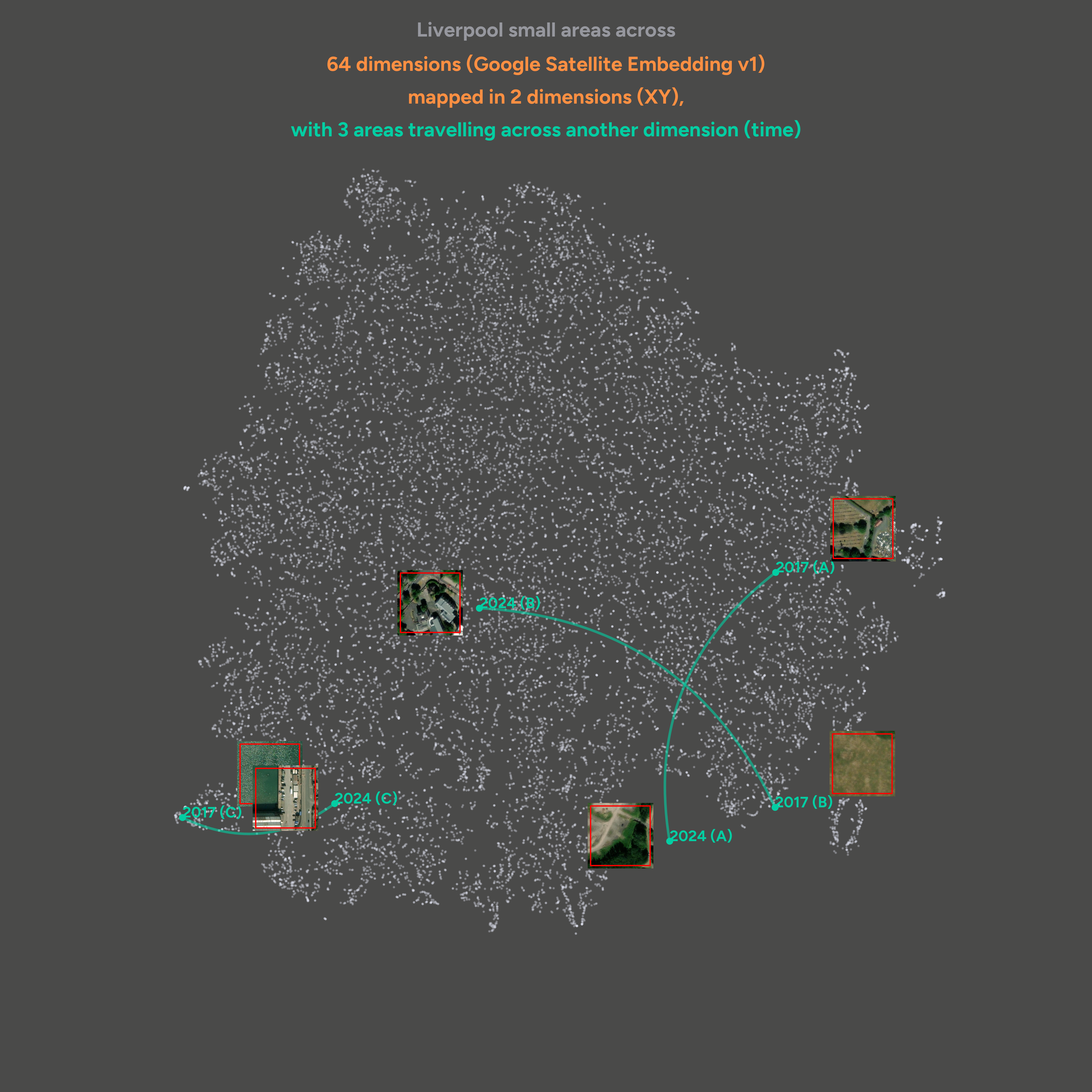
This “map” is a projection to 2D of the 64 dimensions provided by Google’s Satellite Embedding V1 for all pixels of 100m x 100m in Liverpool for 2017 and 2024. Each dot is thus one area at one point in time. Because embeddings encode semantic similarity, nearby dots represent similar areas. Three areas (A, B, C) with substantive change are highlighted, and this change can be seen in the “journey” across the map from their 2017 location to that in 2024. Suggestive aerial images are included also to help understand the nature of the change.
Credits:
- Embeddings provided by Google Satellite Embeddings V1
- Aerial images are provided by Esri World Imagery
- Liverpool boundary used to filter pixels by ONS